Two initiatives to help people find more information about Canada’s residential school system have been released.
An environmental scan report provides information about building locations and the condition and ownership of those still standing.
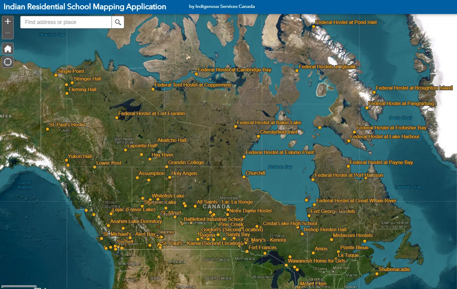
An online mapping tool identifies the location of buildings.
The Former Indian Residential Schools Environmental Scan: Status of Sites and Buildings report was created by Indigenous Services Canada (ISC) and began in 2022-2023.
Available research and datasets were used to determine the condition and ownership of sites and buildings.
The National Centre for Truth and Reconciliation was commissioned to develop a companion report that sets out considerations, approaches and principles that should be taken into account when considering future use or protection of the sites.
The online mapping tool was created to allow users to visualize the location and historical context of the former sites.
“The foundation of reconciliation is truth. People in Canada for too long have had the truth of colonialism hidden from them, harming us all, and delaying the healing that is essential to our country’s health and prosperity,” states Patty Hajdu, Minister of Indigenous Services.
” This new tool will empower Survivors and communities in their journey toward healing from the pain and trauma caused by residential schools. It will also advance Indigenous Data Sovereignty and provide another tool of self-determination.”
Both initiatives can be found on the Government of Canada’s website.
Of the 140 schools that existed, buildings on over 30 sites have since been repurposed.
Some are now elementary or high schools, office space or have been preserved as historical sites.